While the girls were off enjoying their testicle-free weekend in Stone County, I packed my panniers/saddlebags and headed to Newton County to check out some of their finest gravel roads. I invited several others, but none took me up on the offer… perhaps they knew something I didn’t?
I decided to drive up on Saturday morning and start my ride at the Sam’s Throne parking lot and from there I had laid out a 40- and 20-mile loop. The plan was to return to my starting spot after riding 40-miles but just in case the route chosen was too hard, I was going to carry my full camping kit.
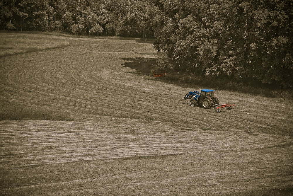
After a rapid decent into Mt. Judea, I stopped at the general store and bought a coke and then I headed over to the Eagle Rock Cafe to verify their hours of operation (Mon-Sat 8-8, Sun 12-3) and then headed out of town on a county road where I spotted a farmer “haying” his fields.
Soon after this pretty scene, I got my first taste of gravel. The road was pretty easy to ride on as long as it was level. Once the incline increased, the going got tough. Trying to balance at low speeds is one thing… but balancing while avoiding rocks and bumps is much harder. I’m not (too) proud so off the bike I went and pushing was the name of the game.
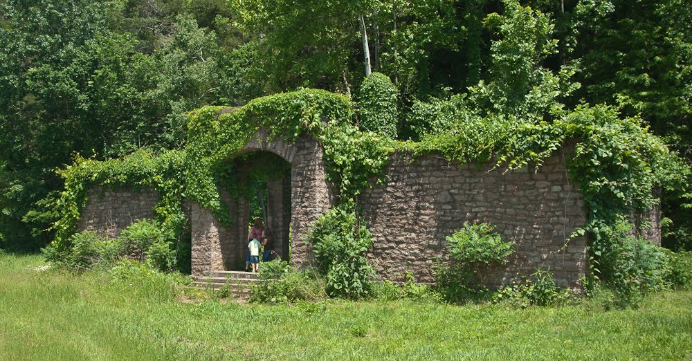
After a couple of miles I was back on pavement and rode through the community of Vendor. Their old one-room schoolhouse can still be seen on the way through town (photo above) and the spring behind it is still running. As far as I am aware, Vendor doesn’t have a school anymore and those kids probably go to school in Mt. Judea.
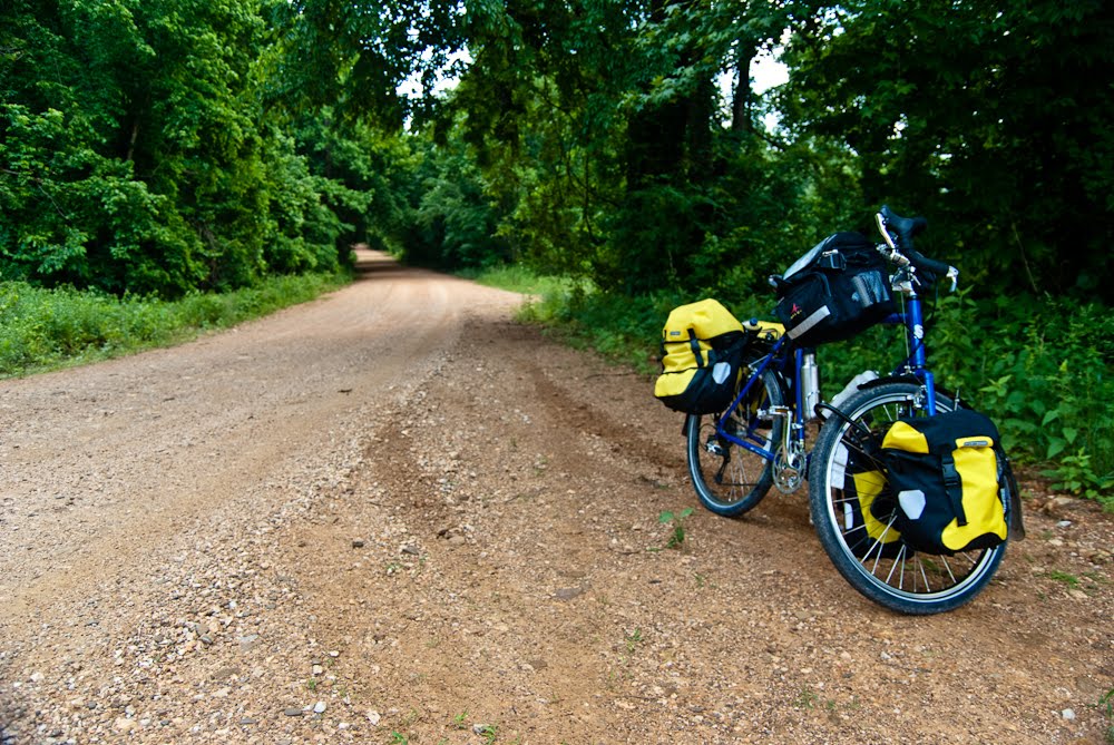
This pavement wasn’t to last though and it was back to gravel after a few miles. I should note that the route goes uphill from Vendor until after you get to Hwy. 7 (~9 miles). The gravel that was “flat” continued to be very nice to ride on but as the grade steepened from 4% to sustained 8%, 9%, and 10% there was more walking involved than riding. The grades, according to my bike computer/altimeter, would hit 14% at times!
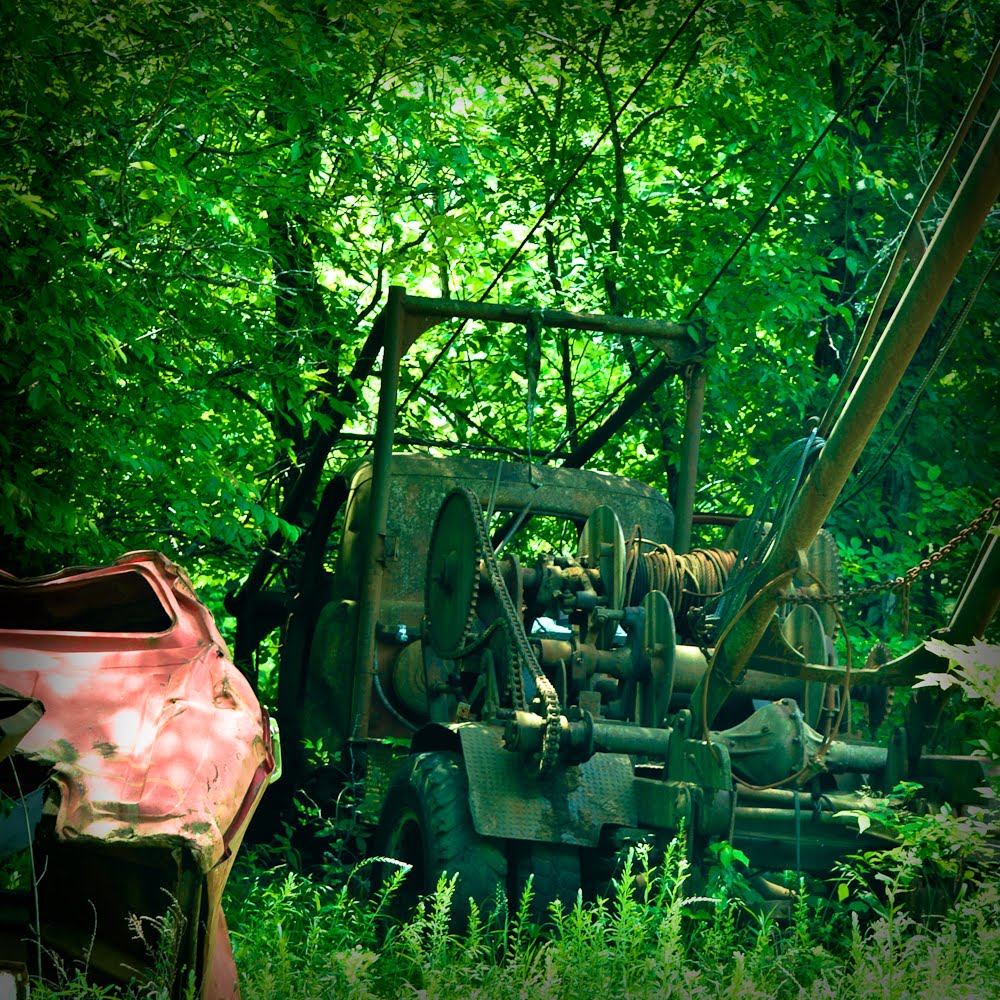
Somewhere along Big Creek, there are dozens of cars abandoned on the hillside. They are above the road, below the road and across the creek. I stopped counting after twenty and instead took a photo of an old truck-mounted crane that was decaying in the woods. I know from experience (hiking around looking for caves) that further upstream there are more cars abandoned on the hillside. Who knows why here?
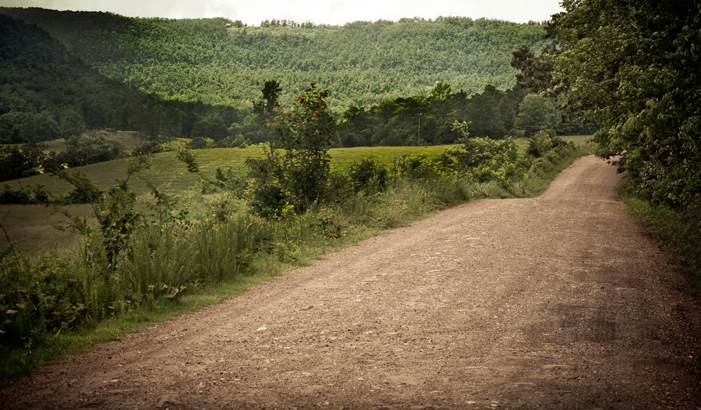
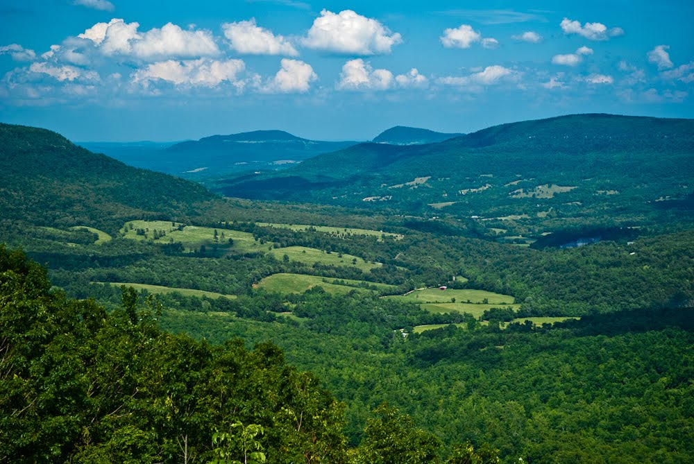
In the photo above, just to the left of center at the very top of the photo, you can see an area without trees. At the time this photo was taken, I didn’t know that several hours later I’d actually be standing there and looking back at this very spot.
Shortly after taking these photos, I was faced with a “Y” in the road. Left went down and right went up. The map I had wasn’t too great and I figured the idea was to keep heading uphill to Hwy. 7 so I went right. Turns out that in an hour or so I’ll figure out that this isn’t the correct choice. Oh well, it’ll still get me to Hwy. 7 eventually.
After several grueling hours, several more miles of uphill gravel roads and finally a set of steep switchbacks, I managed to reach Hwy. 7 and I wasn’t feeling good at all. It was VERY hot and humid this weekend and unlike when backpacking, there isn’t all that much shade on roads. So I stopped at a pretty overlook and noticed a red barn down in the valley that looked suspiciously like the one I had passed hours earlier. Matter of fact, I had stopped near that barn and taken a few photos. Neat!
You’ll have to enlarge (click on) the photo below to see the red barn.
So I sat down and rested for nearly an hour in the shade of a tree along Hwy. 7. Did I mention that I wasn’t feeling good? I was also down to about a half-bottle of water, and I wasn’t anywhere near my vehicle. I looked over my maps and decided that I should head south on Hwy. 7 and turn on the road I should have been on had I not made a wrong turn earlier. As mentioned, I was familiar with some of this area due to previous cave trips so I knew at the bottom of that road there would be a nice grassy field for camping and easy access to the creek for some much needed water.
The three mile ride down to camp was much faster than I would have liked. Remember how steep I said the road was on the way up? Long stretches of 8-10%, except now I’m going downhill at break-neck speed, trying to squeeze my brakes hard enough to reduce my speed but not so hard as to skid out. Switchbacks were particularly trying. I stopped a few times to let my hands relax and my rims cool off. How long can you go before your rims overheat?
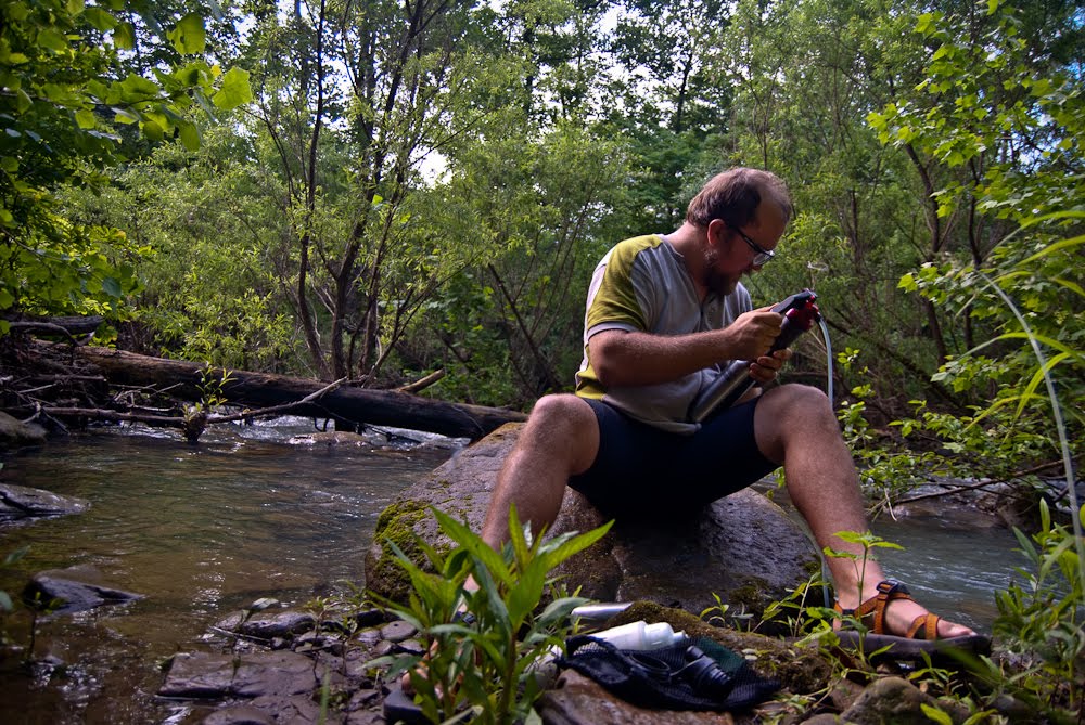
Once at the bottom, camp was set up quickly, water pumped and dinner started. While my freeze-dried Beef Stroganoff rehydrated, I hung my sweaty bike shorts up and got my sleeping bag and stuff situated in my Hennessey Hammock. I find sleeping in the hammock to be extremely comfortable, more so than most nights in a tent though the recent discovery of 3″ thick backpacking air mattresses means the tent is not out of the comfort race yet!
BTW, the shirt I’m wearing in the above photo is a wool cycling jersey from Ibex. I was very interested in the claim that wool shirts have “no odor” so I made sure I wore the same shirt for two days and didn’t once wash it out. I (and Aly agrees) that even after two SWEATY days of bikepacking, the jersey didn’t smell bad at all. It didn’t smell like it was fresh out of the laundry either but it was extremely inoffensive.
So anyways, the next morning I pumped more water, ate my oatmeal and freeze-dried eggs and bacon and then headed downhill back to Vendor. I found the intersection where I made my wrong turn previously and smiled. No big deal, it turns out. I wouldn’t have wanted to push my bike up the road I came down on yesterday evening anyway!
I made sure to drink more water today and when I got to Vendor I filled up a bottle from a church spigot and then stopped at the Post Office for a snack break. I wasn’t far from Mt. Judea and should arrive at the cafe shortly after it opens at which point in time I planned on enjoying the air conditioning, the iced tea and a hamburger/fries.
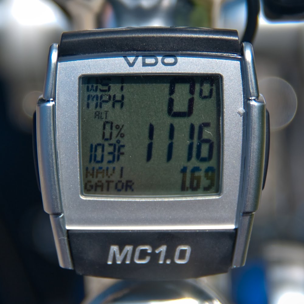
I spent about 45 minutes at the cafe and man that iced tea was wonderful. I delayed as long as possible since I knew that while it was less than 5 miles to my vehicle… most of those miles were uphill. And did I mention it was hot today too? Here’s what the thermometer on my bike computer said the temperature was when walking in the sun, on an asphalt highway, up the side of a big freakin’ mountain!
So I made it… walking up the paved road was actually less painful than anticipated and easier than the gravel road I had walked up the day before. I made it from the cafe to my vehicle in about two hours even though there was a lot of walking involved.
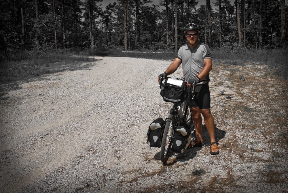
Here’s the “final” photo before I unloaded the bike. Click on the photo to check out the beard I’m currently sporting… it won’t be there much longer.