Colorado Vacation, Part 5: Long’s Peak Loop

This is a multi-part trip report, if you haven’t already you should start with Part 1. Remember too that you can click on any of the photos to see larger versions of them.

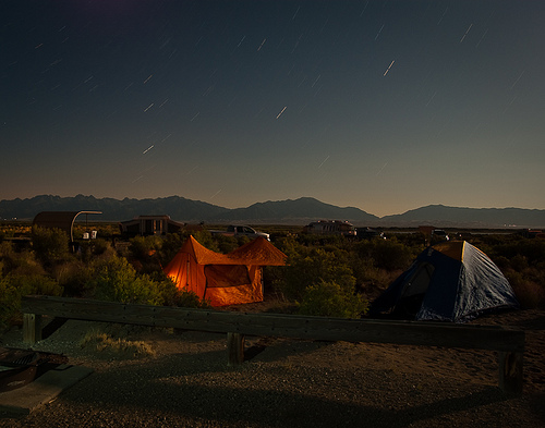
This morning at Moraine Park, we got the highest compliment possible from a fellow tent person in a car campground: “You’re so quiet.”

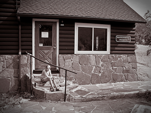
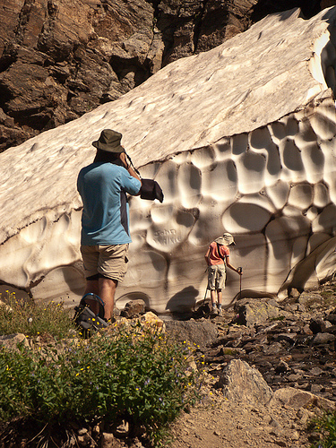
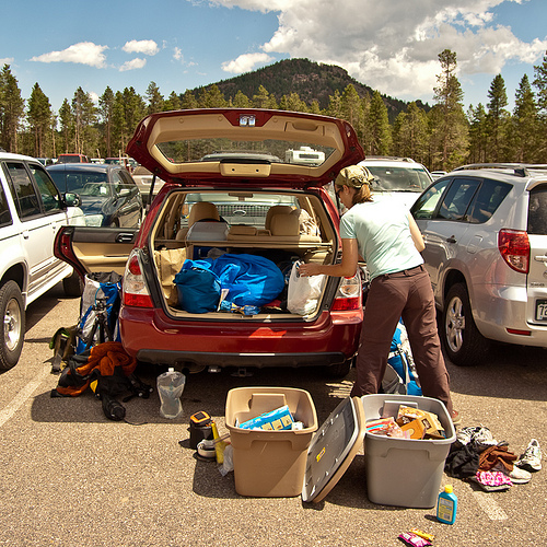
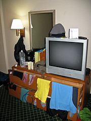
Today’s our day off. After yesterday, we need one. I’m up early, repacking the food bin, sorting out all the stuff in the back of the car. We’re heading to Estes Park for a quick breakfast and a trip to “Dad’s Laundromat” but first we need to pick up our next backpacking permit.

Backcountry office

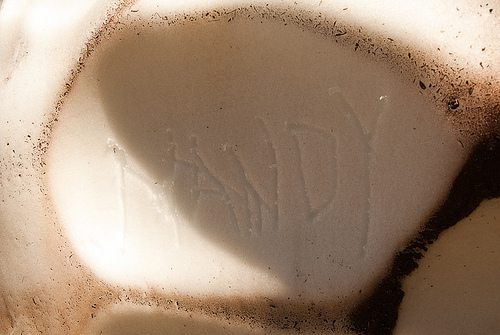
After breakfast, Bryan and Mandy drop me off at the laundromat and run to the outdoor store for a water pump attachment and new boot laces while I finish up with the clothes. We’re all grumpy this morning for some reason we don’t understand, and it’s hard to take sides when everybody’s wrong, but clean shirts and new boot laces help a little.

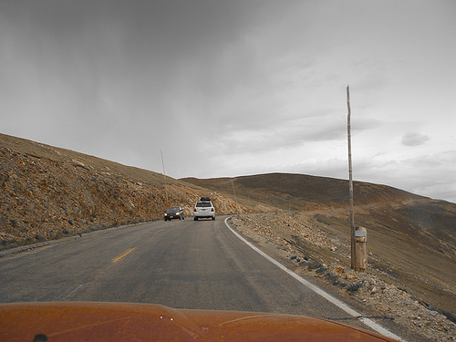
Bryan’s been looking forward to showing us Fall River Road, and we leave just after noon to experience it in all its gravelly one-way glory. We’re quickly past the twisted, sparse trees to above treeline, and it feels like we can see forever. Mandy has fallen in love with this landscape, even more than the other places here in the park.

Mappity

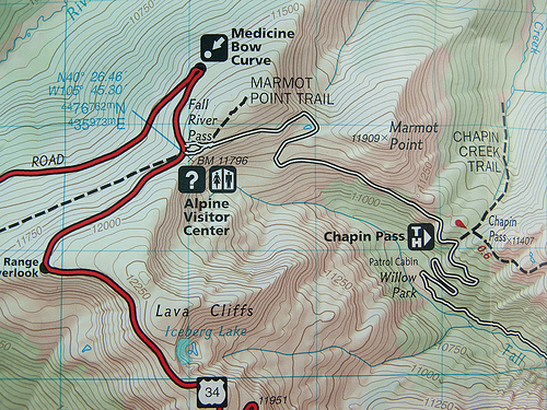
This gravel road was the original route through the park and over the continental divide but, due to maintenance issues, they had to construct Trail Ridge Road (the highest continuously paved road in the US) which we’ll take on the way back.

Trail Ridge Road

At the Alpine Visitors Center we learn the difference between a glacier and snowpack but don’t take time to stay for the ranger program on lightning. The roof is covered with heavy wooden timbers to keep it from blowing away; winds here regularly get to above 100 mph in the winter and the center is only open for a few months in the summertime each year.

Park-n-Ride

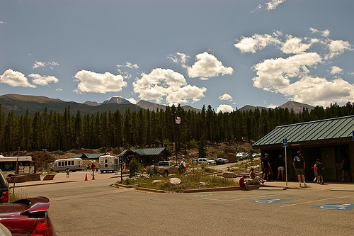
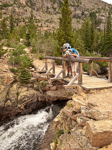
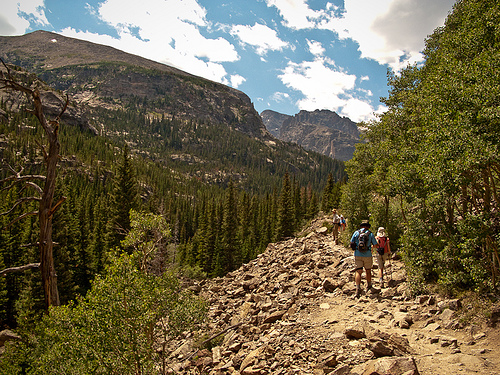
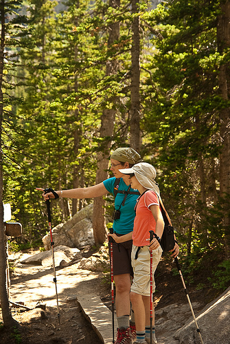
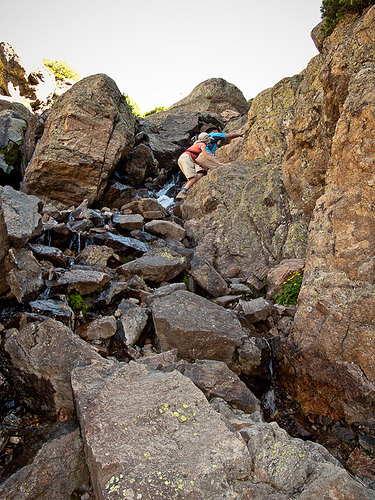
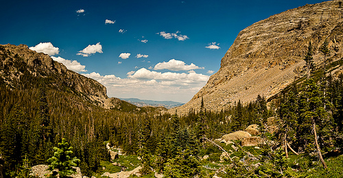
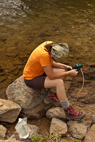
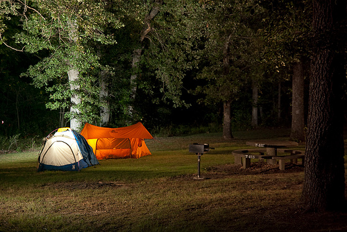
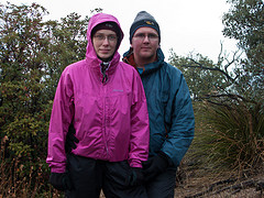
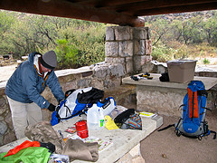
We return to the parking lot, repack, and catch the shuttle back to the Glacier Gorge trailhead for a short uphill hike to the Boulder Brook backcountry site, where we’ll spend the night. We hike in our big packs through throngs of tourists up to Alberta Falls, where we take the North Longs Peak trail and abruptly find ourselves completely alone. We hike about three miles this afternoon, without seeing any other people, on the gently upward slope of a very nicely built trail. We stop a couple of times this afternoon, to pump water, to put moleskin on a hot spot on Mandy’s toe, but generally we feel good and make decent time.

Neat creek

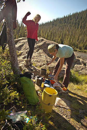
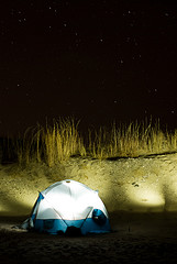
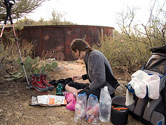
We’ve been trying hard to take care of ourselves. Bryan set his watch’s alarm to fifteen minutes, and when it goes off we take a quick break and a drink. We can tell that our bodies are getting used to the thinner air at this altitude, and for the first time today we hike without uncomfortable breathing. We get to camp just before dark and after working together to set up the tents, Bryan pumps water while Mandy and I start supper away from camp, boiling water and measuring it into the foil pouches that hold beef stew and pasta.

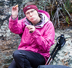
I realize that I’m still too close, so I find a place farther from camp and carry the food, wrapped in my down vest for insulation, to the new kitchen area. In the process, I ooze spinach puttanesca all over my vest! While Mandy and Bryan eat I have to go to the creek in the dark to wash my vest out, and by the time I hang it from a tree to dry my remaining supper is ready. We get things organized for tomorrow’s early morning and we’re in bed, at around 10,000 feet, by around nine. I sleep well despite being certain that my nice vest will be devoured by creatures in the night.

Oh-three-hundred came much earlier than we wanted it to but even Mandy got up and around without complaint, shoving her feet into boots in the dark. We decided, sometime shortly after our stop at the group campsite privy, that someone needs to produce a tshirt with a list of “Privies of Rocky Mountain National Park” with elevations and boxes to check off. The weather’s nice — not as chilly as we expected — and the hike goes well.

I keep thinking about bears. Not nice bears. Though we haven’t seen one, there have been several reports of bears, many of them mamas with cubs, on our hikes on previous days. Our previous trips in the past year have resulted in run-ins with large scary creatures, and I keep expecting this one to be no different. It’s very, very dark. And then we step across some VERY FRESH BEAR POOP in the trail. We keep going along at a good clip but we’re too sleepy to remember the words to any songs. I remember this as a very difficult portion of the day.

Sunrise from near Granite Pass

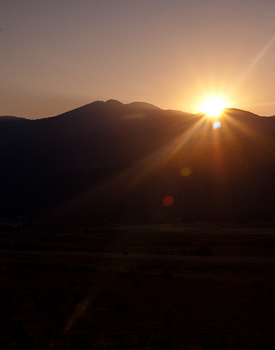
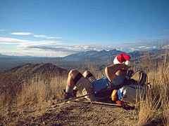
Dawn comes on the side of Battle Mountain. We’re well above treeline and I take a break while Bryan and Mandy take some photographs; I’m having trouble breathing, though Bryan and Mandy are fine. It’s not much farther to Granite Pass, where we’ll meet up with the East Long’s Peak trail and the steady stream of other hikers who will try to summit today.

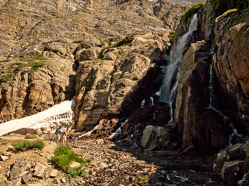
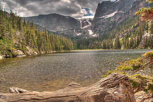
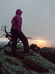
Just at Granite Pass it starts to drizzle. It’s not cold, and it’s not raining much, so we pull out our raincoats and keep walking up the switchback trail to the boulderfield. The view from here is stunning, even though it’s misty; we walk through high meadows of green grass dotted with big rocks, and we see mountains spread out in the distance for miles and miles and miles.

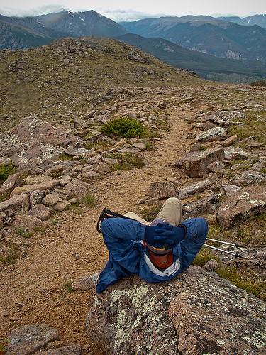
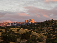
By the way, in the photo below you can see how Longs Peak was shrouded in clouds (hint: Longs is in the top center of the photo).

Rain makes us unhappy

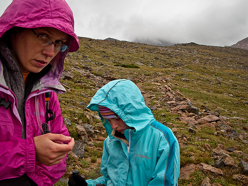
It rains more and more as we get to the Boulderfield. People who’ve slept here huddle unhappily outside their tents, next to the stone windbreaks. We can see people standing in the keyhole above, deciding whether to go forward with their climb. We watch a marmot scurry around, his tail moving in quick circles as he runs, excited by all the people in his backyard. The people are less excited, because we’re all trying to decide whether to turn back or go forward.

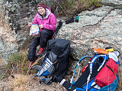
The rain continues; now the whole sky is layered in gray blankets as far as we can see. Long’s Peak is socked in clouds; we might be able to make it to the top but we wouldn’t be able to see a thing from there. The exposed portions of the steep trail will be slippery in the wet. We’re frustrated; I’m breathing better and feeling fine, Bryan’s not sick as he’d been last time he’d tried Long’s. Mandy’s in fine shape, too; our whole week has been planned so that we’d feel good at this point in our Long’s Peak hike, and we do feel good, but the weather is awful.

Resting on way down from Longs

We start slogging down the switchbacks in the rain, toward our base camp. Mandy is disappointed but a good sport; Bryan’s really much sadder than even he’d anticipated but he tries not to show it. At Granite Pass we stop to rest, and a couple of hikers stop to visit. They hadn’t summitted either; in fact, only one person had, quite early, and he’d been turning other people around as they came up the mountain.

Knarled wood

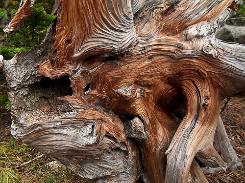
After the first disappointment wears off, we enjoy our hike down. Mandy hams it up, doing inexplicable Elvis impersonations and farting cheerfully. The mist shrouds the farther mountains but we can still see what we missed on the way up the trail in the dark. Near treeline the scrubby twisted trees, called krumholtz, are interesting and alien, and farther down we pass through woods full of enormous, twisted, dead spruce trees. Decimated by fire a hundred years ago, the woods in this area still haven’t fully recovered. Mandy makes up songs about the relative size and tastiness of small woodland creatures:

“I want a chimpmunk for breakfast,
a squirrel for lunch,
a pica for supper,
or maybe a bunch.”

We get back to our base camp at Boulder Brook around noon, already having hiked ten miles for the day. We crawl back into our beds in a light rain and fall asleep; this may be my best nap ever. The sun is starting to peek out when we wake around three. I vote not to hike out this afternoon; our plan was to spend another night here, but I can’t argue against the practicality of a head start and I let myself be bribed by the promise of another cheeseburger from the Rock Inn. We pack up camp and head downhill.

Boulderbrook campsite

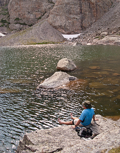
The Boulder Brook trail appears to be the bastard path of the national park. It’s steep but very pretty, totally untraveled, and while it was built well it now seems to be entirely unmaintained. We follow the stream that, in this morning’s boulderfield, was barely more than a trickle; now it’s a substantial and steep creek rolling down from the mountain. We’re back at the car at six, and reflect on the wisdom of the day’s decision not to keep climbing. The sky’s blue down here, and the day’s turned out warm, but Long’s Peak above us is still socked in clouds.

We have to try two visitors’ centers before finding one with good t-shirts. Later, driving through Estes Park, we can’t help picking out the places we’ll go on our next visit, the things we were interested in but didn’t have time to do this time, the items to look at when we come back to try Long’s Peak again. We have another excellent cheeseburger before heading back to the interstate, toward home.

The story continues…
Part 4 – Part 5 – Part 6

Colorado Vacation, Part 4: Sky Pond

This is a multi-part trip report, if you haven’t already you should start with Part 1. Remember too that you can click on any of the photos to see larger versions of them.

After throwing our backpacks into the Subaru and repacking light daypacks, we’re off on the shuttle again for the Glacier Gorge trailhead and the walk to Sky Pond. We think it should be about three miles, according to our National Geographic Map (which we’re learning not to trust). The trailhead signage indicates that it’s closer to five miles. We’re starting about noon and have to be back by seven for the last shuttle, so time’s on our mind as we start out. If it really is a ten mile round trip, with this much elevation change we’ll really have to hustle.

Moving along

We pass the Loch, where we pump water and squint at Timberline Falls in the distance. We watch a foreign tourist clown around on a rock in the middle, and Mandy has a long portrait session with a chipmunk before getting fussed at when he climbs on her camera bag and she calmly picks him up and sets him on the ground.

Another tourist goofing off

Chipmunk

Around here the crowd thins quite a bit. The trails are so good, throughout the park, even the farther-out trails that get less traffic. They’re well engineered and well maintained. In places we pass little flags with notes for maintenance crews to smooth the surface or install lines of rocks to divert the water and keep it from washing out the trail.

Aly and Mandy

Mandy’s first snowpack’s here, and the beauty of the falls is completely lost on her as she happily writes her name in the crusty white wall before stabbing at it with her hiking poles until we make her stop.

Timberline Falls

Behind the scenes

Snowpack graffiti

We scramble up the edge of the falls and don’t even stop at beautiful Glass Lake. We get to Sky Pond at about 4:30 and waste no time removing socks and shoes to dip our toes in the frigid water just below the snow. We laugh as we see the oily yuck from our dirty feet float to the surface of the water.

Climbing TImberline Falls

Bryan soaks his feet at Sky Pond

We have the lake almost to ourselves, and we take a few minutes to admire the Petit Grepon and the Sharks Tooth. Yes, Mandy says, it was worth the hike up. Yes, she says, this is much, much better than Disneyworld. In Disneyworld there’s no treeline, and there’s no lake that makes your whole foot numb if you put it in for three minutes.

View from Timberline Falls

We leave Sky Pond a few minutes before five and make it to the trailhead right at seven; we’ve hiked five miles in just over two hours, and we’re beat. We catch the next-to-last bus back to the Park and Ride and set up camp back at Moraine Park before a trip to the Rock Inn Mountain Tavern (see video below for a quick look around this great restaurant) for good sweet potato fries and cheeseburgers made with local beef on organic buns. The bathrooms have warm water, and there’s ice in the glasses, and tonight we don’t take those things for granted. The Rock Inn’s playing bluegrass music at the edge of hearing, and it’s wooden and dark.

After a thirteen mile day, Mandy’s one tired little girl and we can’t pretend to be in much better shape. It’s time for bed.

http://www.youtube-nocookie.com/v/uHk22EwMe1s&hl=en&fs=1&rel=0

The story continues…
Part 3 – Part 4 – Part 5

Colorado Vacation, Part 3: Spruce Lake/Sourdough

This is a multi-part trip report, if you haven’t already you should start with Part 1. Remember too that you can click on any of the photos to see larger versions of them.

Moraine Park

This morning we pick up our first backcountry camping permit before driving into Estes Park for breakfast and to pick up our bear canister. We resolve a strange mixup about the container, buy Bryan a funny collapsible Chinese hiking hat thing, and hurry back to Moraine Park to pack up camp. At the Park and Ride lot, we disgorge the entire contents of the Subaru into the parking area. After packing for our first two-night loop, we catch the shuttle to the trailhead.

Our gear hauler

It’s a great day. The sky is blue with cheerful puffy clouds, the mountains are beautiful, and the temperature is perfect: slightly too warm when hiking but slightly chilly when we stop. There are lots and lots of people crowding the trails for the first two or three miles, though past Fern Falls the tourists thin out. I begin to think we won’t make it to camp before dark, but after the trail junction at Fern Lake our path to Spruce Lake goes mostly downhill and we make good time. The spruce trees here look silly, like pines with heavy bodies and short arms. We’ve walked about five miles in about five hours, which isn’t bad considering that we have heavy loads and we’ve walked uphill all day; we’re at nearly 10,000 feet now. We have the tents up and water boiling before night falls on our own private lake.

The privies at these campsites are well done; Mandy says “Haha! I peed in a can in the woods!” There are no structures at all, just a dugout hole below a plywood platform and a metal toilet with a cover, facing away from the trail into the woods. Mandy’s up first this morning, racing down to the lake with her camera before coming back to her tent to read a bat book. The lake is beautiful in the morning light: the trout swim in clear water under the glass-calm surface, rimmed with spruce, framed in mountains. We lie in the warm orange tent enjoying the stillness before a busy day.

Spruce Lake

A little later, we cook breakfast next to the lake and then lie on a big warm rock together at the edge of the water, dozing in the sunshine.

Breakfast at Spruce Lake

The hike out to Fern Lake is pleasant; the trail builders have laid half-timbers across the marshy spots where wildflowers still bloom. It’s a dry, breezy day, and there’s lots of traffic on the main trail here; we stop for a snack at the ranger patrol cabin before walking along the edge of the lake. Sitting next to her baby carrier, a mom rests on the shore of the lake nursing her baby. (She’s at least five miles from a trailhead: good for her!)

Odessa Lake

We stop at Odessa Lake for lunch and to pump water. The chipmunks here are convinced that we’re cooking just for them and we have to keep a close eye on our packs and lunches. We’ve been walking through postcards all day, quiet lakes reflecting green trees, with treeline not far above us, topped with layers of rock and snow and deep blue summer sky.

Chipmonk at Odessa Lake

I walk down a bit to find a better place to pump water and enjoy a little quiet. I can barely hear the murmur of Bryan’s and Mandy’s voices nearby. Mandy has started saying things like “In a few years, when you come here to visit me…” She’s decided to move here as soon as possible. Apparently this conclusion was reached somewhere between The Pool and Fern Falls, without the need for much discussion with us.

This week feels like a gift, some kind of grace, a few days stolen between the busyness of summer school and Tulsa trips and the beginning of fall classes and chores.

Pumping water

After Odessa Lake, the trail goes up. And then it goes up, and up, and up. These mountains are big in a way we didn’t understand from just looking; it’s something one realizes quite clearly when one has hiked uphill for two days straight. The views from this section of trail, from the big boulder fields we traverse, is stunning. We’re all still cheerful; even Mandy is happily slogging along in her big pack. Today we hike 4.3 miles in 5.5 hours, including the lunch stop, and we’ll sleep tonight at just over 10,000 feet.

Mandy faces

Just after arriving at Sourdough camp, a big mule deer comes to visit, and he returns several times during the evening. Bryan and Mandy go after water and I cook supper a distance from camp. Our packets of warm food are tucked inside my vest to cook, and I have time to sit and think: why do we backpack? I say it’s to get away from people, to have places like these all to ourselves, and that’s true. Crowded campgrounds are sad and irritating, too close to too many people. But there’s something else, too, something that isn’t so easy to explain. Backpacking, I think, reduces the day to its essential elements. We walk. We get water. We cook food. We set up shelters. We are a family. And that’s all. Life is so complicated, sometimes; backpacking reduces it to its essentials, if only for a few days.

Mule deer at Sourdough

After supper and a trip to the privy, we all sleep well. We’re up early to hike out, and easy hike downhill to the trailhead.

Pond near Sourdough

The story continues…
Part 2 – Part 3 – Part 4

Colorado Vacation, Part 2: Great Sand Dunes

This is a multi-part trip report, if you haven’t already you should start with Part 1. Remember too that you can click on any of the photos to see larger versions of them.

Up before sunrise, we leave the tents and bundle up to drive to Great Sand Dunes National Park. The outlines of the mountains and dunes are visible as we get there, and we walk out into the softly lit sand (and cold wind) to watch the sunrise. The Sangre de Cristo mountains look distant still, in misty dawn light, but the dunes glow warm and pink as morning comes.

Great Sand Dunes National Park
Click to see this panorama in a bigger size!

After some time spent taking photographs dunes around us, Mandy and I leave Bryan with his tripod and walk toward the nearest dunes. We reach the top of the first one just as the first rays appear.

First light

Mandy stands at the lip of the next dune, with her camera held up. She looks for all the world like a very short National Geographic photographer, working in some exotic and dangerous foreign assignment. It’s only for a moment, though; she holds her arms up, yells, and plunges down the side of the dune, suddenly a little kid again.

Happy

After a stop at the small but excellent visitors center, we fill out postcards and eat breakfast at the restaurant just outside the park. The food’s no good but the decor features a mounted head with an antler protruding from the stuffed thing’s forehead.

Weird Deer

We make a quick stop back at San Luis Lakes to pack up camp, and Bryan naps in the car until a stop in Blanca where a detour to the tiny post office leads us past a fence made entirely of cross country skis.

Ski fence

In Pueblo we stop at Chipotle for an excellent lunch, and I nap until Colorado Springs. The drive up the front range is pretty, made even more fun by Mandy’s excited amazement. “It’s so beautiful,” she says. “Wow, look at that one!”

The REI “Flagship Store” in Denver is huge, an old brick warehouse converted into a store, with exposed metal beams and a 45 foot indoor climbing wall. Arriving only an hour before closing time on Sunday afternoon, we practically jog through the store, stopping long enough to snag a few items on our list, including a new harness for Bryan and some purple climbing shoes for me. The store sits near the river, and there’s a little park on the grounds with boulders for kids to climb on, statues of animals, and aspen trees. It’s right on a walking and bike trail, next to Confluence Park‘s water play area. Even on a Sunday evening, the park is crowded with inner tubes and pool noodles and people splashing in the shallow water. The whole area is very busy, not with cars but with people on foot and on bikes.

In Boulder, we drive around until Bryan finds a place in memory: the Pearl Street Mall. It’s a great outdoor shopping area with interesting stores and street performers and the smells of good food. After stuffing ourselves silly on pasta and cheesecake, we walk back to the car and drive to Rocky Mountain National Park.

We arrive late but the Moraine Park Campground people helpfully list the names of the campers arriving after the kiosk is shut down; we quickly find our name and campsite number and set up tents, again, in the glare of the headlights. We’ve driven 1353 miles since leaving home, and we’ll sleep well tonight at over 8,000 feet.

The story continues…
Part 1 – Part 2 – Part 3

Colorado Vacation, Part 1: Home to San Luis Lakes

Remember that you can click on any of the photos to see larger versions of them.

We leave Benton at six and arrive late at Lake Eufala State Park. We get a nice, flat tent site far away from anybody else, and we set up camp in the headlights of the car. The bugs are terrible and it’s very hot; we’d packed sleeping bags expecting chilly temperatures at elevation, and didn’t really think about the night or two we’d spend in the muggy midwestern summer.

Lake Eufala State Park, OK

We wake up sticky and gross, but since we leave before seven, the campsite’s “free”. We stop in Okemah to see the first exciting roadside attraction of our trip: a row of three water towers helpfully labeled “HOT”, “COLD”, and “HOME OF WOODY GUTHRIE.” The hand dryers in the Valero gas station bathroom are incredibly powerful: we giggle as the skin on our hands and arms flaps loosely. We’re in a place we’ve never been before, and it feels like our trip has started.

Hot, Cold and Home of Woodie Guthrie

Bryan’s been inexplicably excited about seeing the Oklahoma panhandle, so I helpfully drive so that he won’t miss a minute of the tremendous excitingness of, um, not much. We play a game in which we have to find things starting with each letter of the alphabet. It takes nearly an hour and includes two minor arguments and such thrilling items as “C is for Cows” and “N is for Nothing.”

Panhandle of Oklahoma

I don’t mind driving on trips, I really don’t, and I try to explain this to Bryan. What I mind is that, when he’s the passenger, he’s bored. He sings. He pokes people. He makes stupid trumpet noises with his mouth. He starts arguments about dumb things just to entertain himself. Today he discovered “licking by proxy,” a technique in which he slobbers on his hand and then tries to wipe it on the driver. This is incredibly irritating and, more importantly, seems tremendously unsafe. I try to get him to drive as much as possible; licking by proxy is much more difficult if Bryan is the driver.

On the advice of a coworker, we eat at a ratty-ass motel diner in Raton, New Mexico called The Oasis Restaurant. The review I read had indicated that the food was good but that the carpet in the rooms was threadbare pink shag. (We chose this eatery over the one with the review that said “Bring a gun.”) We all order from the Mexican side of the menu: Damn. Yum.

Oasis Restuarant, Raton, NM

About bedtime, we arrive at San Luis Lakes State Park in Colorado at 7,500 feet. We add layers of fleece and down before setting up tents next to the corrugated-metal ramada. It’s the tallest thing here; all the trees and bushes are waist high. We don’t know what it looks like by day, but the nearly-full moon rising over the nearby mountains, over the lake, is beautiful.

San Luis Lakes State Park, CO

The story continues…
Part 1 – Part 2

Tucson Honeymoon: Day 9

This is a multi-part trip report… if you haven’t already, you should start with Day 1.

Start: Tucson, AZ
End: Monahans Sandhills State Park

Daily Mileage: 565
Total Mileage: 1984

Our hotel room smells awful and looks like an REI explosion, but we’re clean and fed and rested and all our gear is dry now. It’s worth noting that the Fairfield Marriott has an excellent free breakfast, complete with good coffee, lots of pastry choices, a self serve Belgian waffle maker, and all the peanut butter packets you can sneak into your tote bag.


Our gnome likes his morning coffee, and he likes Belgian waffles too

We head east on I-10, a little sad to begin the end of our trip. We take an almost immediate detour and spend a lot of time finding a good spot to take panographic pictures of Tanque Verde Ridge. We hop a curb at an office building and Bryan uses his new pano tripod head, and I take pictures of him taking pictures, and of cholla in the snow.


Bryan and his tripod, camera, and pano head

In places, the towns are an hour apart, which makes for a miserable McDonald’s line on a big travel weekend. We sit in an interminable drive thru; I attempt to use the bathroom but abort the mission when I count 34 other women in line. We listen to “Jesus Don’t Want Me For A Sunbeam” (by Nirvana) on the iPod and then give up on McDonald’s, getting back on the interstate. We’ll get some nuggets somewhere else.

Here is a quote from my travel journal, written while flying down I-10 at 75 miles per hour:

Soaptree yuccas are stupid looking plants, like wandering midgets with bad hair, drunken and lost, lurching through the pasture grass. Some of them wave toilet brushes above their heads. Are they trying to hail cabs, out here in the weird, lonely west? Do they know how ridiculous they look?

We wander through an outlet mall, then eat supper at Chili’s in El Paso, a generic choice but we’re grumpy and tired. We talk to Mandy and enjoy hearing her cheerful voice, a bright spot in the evening. She is interested in our trip and glad to tell us that she’s impressed her friends in Oklahoma by doing 168 sit ups.

For awhile we parallel the Mexican border, and after dark we enjoy the idea that we’re looking miles away to the south at the lights from another country. About nine o’clock we pull off the interstate with all the other traffic to drive through a border patrol checkpoint. It is unexpectedly scary but after our truck is dog-sniffed and we tell the officers that we’re American citizens, we’re on our way again. The truck stop in Pecos is nasty, and we’re tired and ready to stop long before bedtime.

We arrive at Monahans Sandhills State Park around midnight. The camping spots are all surrounded by dunes of soft, light sand. It’s already below freezing but it’s not windy. We quickly realize that the sand won’t hold tent stakes, so we pull out the North Face 4-season tent Britt and Debbie sent with us. We’ve never set it up but it’s simple and before long I’m sitting up inside it, a luxury after hunching over in the little backpacking tent. Bryan takes some photos while I pop a flash inside the tent.

Saguaro-5338
The stars at night, are big and bright, deep in the heart of Texas!

It’s funny how we get accustomed to chill, and how much more comfortable good gear makes things. I think about the friends who’d never consider tent camping in winter, but I’m cheerfully ensconced in a cozy tent, snug and warm in my sleeping bag, dry socks, down booties and vest.

We all have strange little quirks, and I find one of mine: I can’t sleep with a cold nose. I find a handwarmer and open it, put it on my nose, and quickly fall asleep again. The stars are clear and bright on this last night of our trip.

A selection of additional photos appears below, for more photos from the trip checkout our Flickr page.


Bryan taking a set of photos of Tanque Verde Ridge


An old train in front of the mountains


Teddy bear cholla


New Mexican sign: Their road map spells “Flying” and “Missile” wrong, too


Some of the overpasses in New Mexico were really neat.


Yes, that’s a truck, in a truck, pulling a truck


Worst name for a car dealership? Ever?


West Texas’ answer to the Chik-Fil-A advertising campaign; at least the ranchers can spell.

Day 8 – Day 9 – Day 10

Tucson Honeymoon: Day 8

This is a multi-part trip report… if you haven’t already, you should start with Day 1.

Start: Saguaro National Park (Juniper Basin)
End: Tucson, AZ

Daily Mileage: 14
Total Mileage: 1419

Miles Hiked Today: 7
Miles Hiked Total: 25

I wake early this morning, no doubt a result of our lion-induced super-early bedtime. We both slept better than we expected, I think, and the night passed without incident. It’s been raining for a couple of hours, and gusty. I listen to the iPod in the safe orange cocoon of our tent and wait for Bryan to stir.


Breakfast in bed, sort of.

The rain gives us a little break, so we get up and begin cooking breakfast. I move the packs inside the tent as it starts to rain again, and we finish cooking and eating our meal sitting in the doorway under the little awning. As we eat toasted bagels and oatmeal and bacon, we watch the light winter rain turn to sleet and then to snow.


Our faithful traveling gnome serves as a tent stake, replacing the one lost in the windstorm, while our tent collects snow.

We pump water and pack up camp in the falling snow, then head down the ridge. I like hiking in the snow, and Bryan begins by enjoying it but after several hours the novelty wears off; his feet hurt and he doesn’t like the falling snow in his eyes. The fact is, though, that the snow is beautiful stuff: puffy, Christmassy flakes covering the trail and softening the edges of the world. As we descend we see, again, ocotillo, then more and more yucca and cholla, and finally the first saguaros signaling our much lower elevation.


An uncommon photo opportunity

The lone hiker we’d encountered is gone by the time we get to the Javelina picnic area, and we have three miles of road hiking before getting to the truck. We could both walk the road with our packs, but since his feet are starting to hurt, Bryan volunteers to wait in the damp cold with my bag. I’m grateful to be rid of my heavy pack and enjoy the soggy walk on Cactus Forest Loop Drive. Not a single tourist offers me a ride, but I’m warm in spite of the rain. The far-off mountains are still shrouded in clouds, but the closer, lower peaks are snowy.


I hold Bryan’s pack while he takes a few quick photos and then I snap a picture of his silly grin. Spirits were still high!

The truck is a welcome sight and I drive it slowly back to pick up Bryan, who reports that all the old picnic shelters leak. (Apparently, actual rain shelter is not an important design feature in the desert.) We hurry to the visitors center to check in with the rangers before they close at five; it isn’t a requirement but we want to log our encounter with the mountain lion. They are interested in our story and tell us that a lion had been reported by someone else not long ago, on that part of the ridge. We also fill out a complaint form indicating that the bathrooms should be more conspicuous.

h_saguaro snow pano_6 pics_41 copy
Click the photo to see a larger version since it is stitched together from six images to form a 41 megapixel image.

I come up with a plausible reason for another hotel stay: our gear is all soaked, and we need to be dry and organized before starting home. The hot shower and clean socks feel good, and so does the prospect of a big supper.


Marriott provides whole-room gear-drying services

I love the fact that we have a favorite restaurant in Tucson. We wait for our table in El Charro’s bar, and when we’re finally sitting in the warm dining room we enjoy our enchiladas and tamales and tres leches cake. We’re tired but not miserable, at least as long as we don’t touch our calves, which were fine earlier today but are now suddenly very sore.

Day 7 – Day 8 – Day 9

Tucson Honeymoon: Day 7

This is a multi-part trip report… if you haven’t already, you should start with Day 1.

Start: Saguaro National Park (Douglas Spring)
End: Saguaro National Park (Juniper Basin)

Daily Mileage: 0
Total Mileage: 1405

Miles Hiked Today: 7
Miles Hiked Total: 18

We awake sometime after midnight to a blustery wind and a tent down around our faces. A gust has popped a guy line off a tent stake and part of our shelter has collapsed around us. After Bryan fixes it, the rain starts and it rains hard for awhile, the wind still pounding on the sides of our tent. Around dawn it lets up, giving us time to eat breakfast and pack up our things in a drizzle instead of a downpour.


Aly sleeps late at Douglas Spring

The trail from Douglas Spring to Cow Head Saddle goes up, up, up, with hardly a break. We look ponderous and heavy in our big packs, made even larger by their rain covers. We’ve left the desert plants behind; what’s here is a dense pack of short trees, almost like a miniature rain forest. We’ve had several creek crossings and even a little waterfall. We know that it rained an inch this week, after only eight inches in the past year. We can’t help but smile, thinking that our impression of the Sonoran desert is one of a rather lush and damp place.

The views are amazing from up here. The rugged purple mountains we’d been admiring from Tucson are all around us now. As we climb, we watch the clouds move in the peaks around us, intrigued by the patterns of rain and sunshine. We see two different rainbows today.

We turn right at Cow Head Saddle and head up Tanque Verde Ridge. Our thermometer reads 45 degrees but that’s hard to believe. The wind is vicious, sustained at probably 30 mph and gusting to 40 or so. There are a couple of times we’d each have fallen if we hadn’t been using poles, and once the wind shoved me into a big, prickly yucca.

Bryan finds a strange cluster of large rocks just off the ridge, and we use their shelter as a much-needed windbreak to eat our lunch. We can’t help but notice that the trail has a great deal of scat; apparently every large animal who makes it to the ridge poops on it. We note with some concern that a lot of what’s here is rather large, with a lot of berries. Will we hike with bears today?


On the ridge, we find a windbreak for our lunchtime stop

Finally, after a number of smaller “this must be it” peaks, we reach a sign for the REAL Tanque Verde Peak. We drop our packs and hike, much lighter, the few hundred yards up to the peak. It’s later than we thought but the view is amazing and the golden light near sunset makes for some lovely photos, and we don’t mind the prospect of hiking at night.


Finally, the sign for Tanque Verde Peak

We’ve been traveling through the low, damp woods, with little patches of untracked, old snow. Burned black skeletons of old pine trees rise above the heavy green foliage, for as far as we can see their separate shapes. By the time we reload our packs, it’s already dusky, with about two more miles to go before our backcountry campsite for tonight. The views from the ridge are amazing: eye level with the heavy, dark lower margins of the rainclouds, we look across at the dusky bulk of the next mountains. And, as hard as we’ve worked to get above the city, we still sometimes see the lights of Tucson spread out below us in the dusk.

After dark, our trail crosses several patches of bare rock, and is difficult to follow in spots. At each of these, I stop at the edge of the trail until Bryan finds the route off the rock; this keeps us from getting turned around in the dark and backtracking. We find that, while I like to hike in front for part of the day, I prefer that Bryan lead after dark, since he sees better at night.

About a half mile before camp, Bryan sees two eyes in the woods to our left. They hop hurriedly away and he’s excited to have seen another jackrabbit. Another pair of eyes peers out at him from a bush right near the trail, and he walks forward, turning his headlamp on high to get a better look. He stops, still in the path, with one arm out to block me: “Aly, it’s a cat.” We both take a step backward.

After a moment to collect our wits, we do all the right things: we wave our arms and yell, we throw rocks, and we don’t panic. One of Bryan’s rocks causes the lion to retreat enough that we can continue down the trail past where it was sitting, but after moving off just a few feet, it stops and watches us. Another rock makes little difference: the big cat is just watching.

Bryan walks slowly and I walk backward, just behind him, yelling “We are PEOPLE! We are BIG AND SCARY! Also, we are NOT AT ALL TASTY!” As silly as our words sound, we’re terrified. I move my headlamp from my neck to my forehead, in case appearing just a little taller might help. Bryan walks faster forward than I can walk backward, and I stumble and nearly fall. He slows down, then, and I pay a little more attention to the trail, but still, each time we look back, there are eyes behind us, following.

Sometimes the cat moves off to our left a bit, and sometimes it drops behind us, but always its wide-set eyes are the same distance away, not more than a hundred feet from us. Fortunately, the trail is crossing a rather flat area and we can see some distance. We continue our awkward retreat, still yelling, still moving slowly but moving away. But we don’t lose the cat. We realize, with alarm, that we’re being stalked.

We cross a little stream and the trail dips; we can still see behind and to our right, but the trail runs next to a cut to the left. We lose the lion; he could have stopped following us but he could just as well have climbed up the little hill to our left; he could be fifteen feet from us before we see him again. We hold our flimsy hiking poles and we yell and we know that, if the lion wants to catch up with us here, he can.

We want so badly to walk into the Juniper Basin backcountry site. We start to worry that in our preoccupation with being hunted, we’ve actually walked past it in the dark. But after a few more minutes of loud conversation and awkward backward lurching in the dark, we find a sign that says “Juniper Basin – Campsite and Comfort Station” and we follow its arrow.

The backcountry sites at Saguaro National Park have prefab toilet structures, and we’d used one just this morning at Douglas Spring. We’ve been talking about that bathroom for quite awhile, discussing how nice it will be to have a door to shut behind us, trying to figure out whether or not we can actually cook and eat supper in a pit toilet, puzzling over whether we could both somehow sleep on its floor with the door shut behind us. I’m not sure I’ve ever looked forward to seeing a bathroom quite as much as I was looking forward to seeing the bathroom at Juniper Basin.

We follow the arrow, and we find the first, and second, and third tent sites tucked into the folds of the wooded basin. But we can’t find the bathroom anywhere. We retrace our steps in the windy dark, still watching for eyes, still talking loudly, and still can’t find the structure.

Neither of us is hungry, so we opt to skip cooking supper tonight. We get out our plastic-coated guide and Bryan looks at the animal pictures: yes, he says, the face of the mountain lion on the page is the face he’d seen in the woods. We still feel vulnerable and worried, but we decide that we look less like food if we’re in a big orange tent. We set up camp, looking around us all the time, and we are very careful to put everything else in the metal bear box. We crawl inside the tent eat a “supper” of dried fruit, chocolate and water, and after a time, we fall asleep.

A selection of additional photos appears below, for more photos from the trip checkout our Flickr page.


There’s a bug in Aly’s peanut butter. You can’t see it, but it’s there


Near sunset, near the peak


Photos of both of us are rare, with no one to hold the camera; the peak logbook stands in

Day 6 – Day 7 – Day 8

Tucson Honeymoon: Day 6

This is a multi-part trip report… if you haven’t already, you should start with Day 1.

Start: Tucson, AZ
End: Saguaro National Park (Douglas Spring)

Daily Mileage: 14
Total Mileage: 1405

Miles Hiked Today: 11
Miles Hiked Total: 11

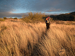
Finally, we’re walking! It’s in the mid-seventies today and the weather is beautiful. It’s lovely, though not at all what we packed for. SmartWool socks are wonderful: my feet are dry but my legs are wet from the moisture that’s wicking up through the fabric. We’ve brought our cold weather gear, which makes our packs comically overstuffed, but we’ll probably need coats and gloves up on the ridge.
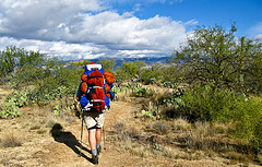

Bryan hikes into the desert

The desert is strange, with the saguaros standing tall amid the spiky alien ocotillos, and the cloud shapes on the mountains and desert add another layer to the weird geometry of this place. I put a hole in my boot when I accidentally wander into an Engelmann’s prickly pear. We disturb a jackrabbit, a surprisingly tall and gangly creature with a rabbit body and long, long legs that make it walk more than it hops.


Mister Jackrabbit, with his amazing legs.

It’s a beautiful day. We take a break near a stock tank by a spring, sitting barefoot on the trail with our opened packs beside us, amidst an odd assortment of drying socks, maps, doodads, and platypus bottles. It’s chilly in the shade. We hear a noise on the other side of a palo verde; Bryan grabs the camera hoping for another jackrabbit. I’m hoping it isn’t a lion or bear, since I have no shoes on. We’re both wrong: it’s an old man, coming down a side trail. He doesn’t hear well enough to understand the joke, and we watch him quietly feed the fish in the tank before moving on.


Lunchtime at the Rock Spring stock tank.

We can sometimes see Tucson below us, a flat grid of streets with tiny mica sparkles of windshields, ringed by the rugged Rincons. The closer mountains are dark purple-brown, the higher peaks sharper and snow-covered. We see lechuguilla for the first time today, and think about how proud Carter would be to see us faithfully consulting our new plastic-covered plant and animal identification book.


Santa Bryan stops to enjoy the golden hour and the view of Tucson

A desert oasis: Bridal Wreath Falls are running, and the excited tanktopped dayhikers tell us we must take the spur trail to see them. Grateful for a break from the weight, we drop our packs near the trail intersection and hike up to see a pretty double waterfall behind the saguaros. The stream crossing below the falls is home to an ancient, gnarled oak overgrown in an enormous cholla, with tiny baby shoots of green grass around its base.


Bridal Wreath Falls, running the day after an inch of rain

Finally, after dark, we arrive at the Douglas Spring backcountry campsite. We join a group of about a dozen teenagers; their leader describes their group as “youth in a program for those with family issues.” We had expected a group of inner city thugs but what we find seem to be spoiled rich kids in Marmot jackets, discussing their addictions, their snowboards, and their architect fathers. There are alarms on their tents and they don’t seem very comfortable in the woods or with us.


Near Douglas Spring: The bleach blond desert grass glows at sunset

It’s Christmas eve, and after we set up our tent, eat our beef stew, and stash our things in a bear box, Bryan takes off the Santa hat he’s been wearing all day. I string up a spare bootlace inside the tent and decorate it with some miniature ornaments I’ve brought along. We exchange small presents and lie awake for awhile, listening to podcasts in our tiny room. Merry Christmas to all, and to all a good night.


Christmas Eve in a backpacking tent

A selection of additional photos appears below, for more photos from the trip checkout our Flickr page.


We hope we don’t run into one of these!


Saguaros are much taller than we’d imagined


Internal ribs support the saguaro’s height and bulk


A cholla cactus


Aly’s favorite desert plant, the teddy bear cholla


Young saguaros; they don’t typically start growing arms until about 75 years old.


An ancient sun-worshipper.


The only down side to trekking poles: it’s hard to eat and walk


Englemann’s Prickly Pear grows up and out; Spreading Prickly Pear grows along the ground


A “grandfather” saguaro


On a warm day, Aly is grateful for a tshirt but more than willing to carry fleece in her pack


Santa Bryan checks a confusing trail marker


Palo verde trees have photosynthetic bark and tiny leaves


The nearby ranch keeps the tank stocked with goldfish, and the park pretends not to notice


We startled a deer in the higher country, near sunset


Aly on the trail just before sunset


One of the Rincons at sunset

Day 5 – Day 6 – Day 7

Tucson Honeymoon: Day 5

This is a multi-part trip report… if you haven’t already, you should start with Day 1.

Start: Colossal Cave Mountain Park (AZ)
End: Tucson, AZ

Daily Mileage: 22
Total Mileage: 1391

I hate getting up. Dawn’s my favorite part of a backpacking day, when the light starts to filter through the fabric of the tent and the hazy outline of the day begins to form inside the warm padding of my down-filled sleeping-bag brain.

It begins to rain during breakfast and we enjoy the luxury of a stone picnic shelter. We each have our own old concrete table to spread out our gear and organize and pack our bags, well out of the wet. We should have left by nine, but the continuing rain and another headache made us move slowly. By early afternoon neither the headache nor the rain have abated, and with both getting worse and daylight wasting we decide not to hike the 14-mile day we’d planned.

We stop by the Visitors Center, amend our backcountry permit, and then head out to explore Tucson. The city looks scruffy, and I know why: no one has lawns. The plants that grow in front of fancy houses are the same as the plants in the bad neighborhoods, and those are the same things that grow on the roadsides and in the ditches: prickly pear, ocotillo, barrel cactus, and cholla. This gives even the most expensive neighborhoods the scroungy ambiance of a seedy trailer park.

Tonight’s plans have changed from a backcountry camping permit to a nice hotel room (Fairfield Inn by Marriott), a hot shower, and an old Mexican restaurant. Bryan does a brief internet search and finds “El Charro”, the oldest continuously operated family Mexican restaurant in the US. The directions provided by Google Maps are almost but not quite exactly wrong, but we find the restaurant anyway, tucked into an odd corner of old downtown Tucson. It’s cheerful and interesting and every bit as good as the reviews: the service is excellent, the red salsa is the best I’ve ever eaten, the chicken and tomatillo tamales are amazing, and the chimichanga we share is as big as a stick of firewood.

In fact, according to their menu, El Charro was the place where the chimichanga was invented. It was first opened in the twenties by a French woman who’d moved to Arizona with her stone-cutter father. It was a family restaurant and her little nieces were often in the kitchen. So one day when she accidentally dropped a burrito into hot oil she stopped herself from cursing by saying “shi……michanga!” The fried burrito was found to be delicious, and the name stuck.


The picnic shelter at El Sevillo camping area, in the Colossal Cave Mountain Park

Day 4 – Day 5 – Day 6